
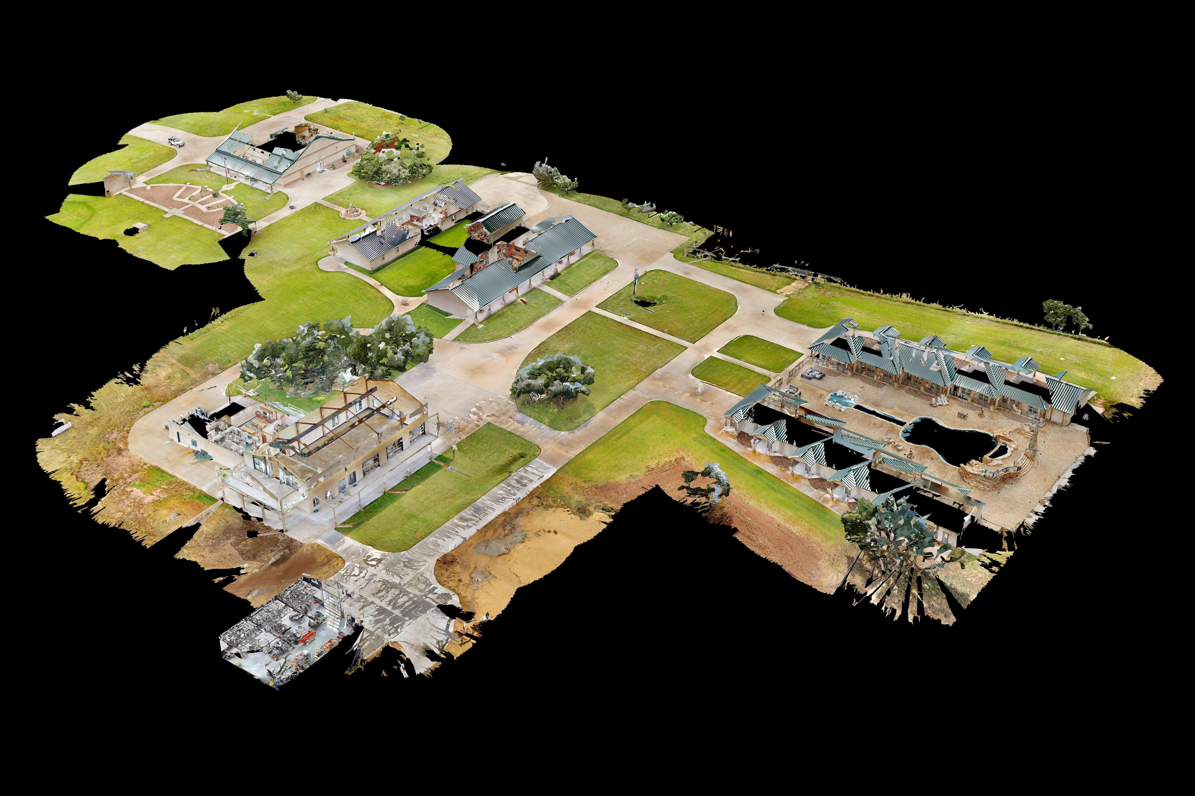
3D tour of a ranch property
AC Ranch
Virtual tour of a luxury hunting ranch in the Texas Hill Country
Ranch & Land
A current, dated aerial map of the whole property, an inventory of roads, fences, water, and structures, terrain analysis, and 3D tours of the headquarters and main home. Everything a buyer, developer, or land trust needs to understand the place.
A listing package that shows the whole property: a current, dated aerial map in standard mapping formats, a feature inventory for the listing sheet, and 3D of the headquarters and main home.
A current record of what you have: roads, fences, water, and structures, mapped and dated.
Existing conditions, slope, and drainage to start conversations about homesites, pond sites, and roads.
Dated, high-resolution aerial imagery to support baseline documentation and annual monitoring.
For visualization and planning only. Our maps, models, and terrain data are not a boundary survey or a legal survey, and they don’t establish property lines, acreage, or easements. Any boundaries we show are approximate, drawn from public parcel data or information you provide. Slope, drainage, and site-suitability findings are planning aids, not engineering or soils studies. For certified survey work, we’ll refer you to a licensed land surveyor.
A current, high-resolution drone orthomosaic, dated the day we fly, with map files delivered in standard formats that work with common mapping and GIS tools.
Roads, fences, water such as stock tanks, ponds, and creeks, and structures, mapped as a layer and summarized in a list.
Slope, drainage, and homesite and pond-site suitability, as a starting point for planning.
An aerial 3D model of the headquarters and structures, paired with a walkable 3D tour of the main home.
A dated aerial record of the property's condition when the easement is placed, and repeat flights each year that can be compared with it. The imagery supports the baseline documentation report and monitoring visits your land trust prepares; it doesn't replace them.
We look at the property on a map together, agree on the area and the deliverables, and check airspace.
We fly with the landowner's permission and coordinate gates, livestock, and access with whoever manages the property. Timing depends on weather and acreage.
We build the orthomosaic, elevation model, and analysis layers, and map the features.
You get files, overlays, and a walkthrough call to go over what we found.
For listings, we can coordinate with the broker and the owner on access and timing.
No. It's for visualization and planning, and boundaries are shown as approximate. Certified survey work goes to a licensed land surveyor.
A current, high-resolution orthomosaic and map files in standard formats that work with common mapping and GIS tools, plus images for listings and print.
For very large properties, we can map the whole place at a lower resolution and the headquarters and key areas in finer detail.
We provide dated aerial imagery that supports baseline documentation and annual monitoring. The land trust or its consultant prepares the baseline report itself.
Yes. We fly with the owner's or their agent's permission and coordinate gates, livestock, and access with the ranch manager.
Acreage, location, and what you need to show or learn. We'll reply with what makes sense.